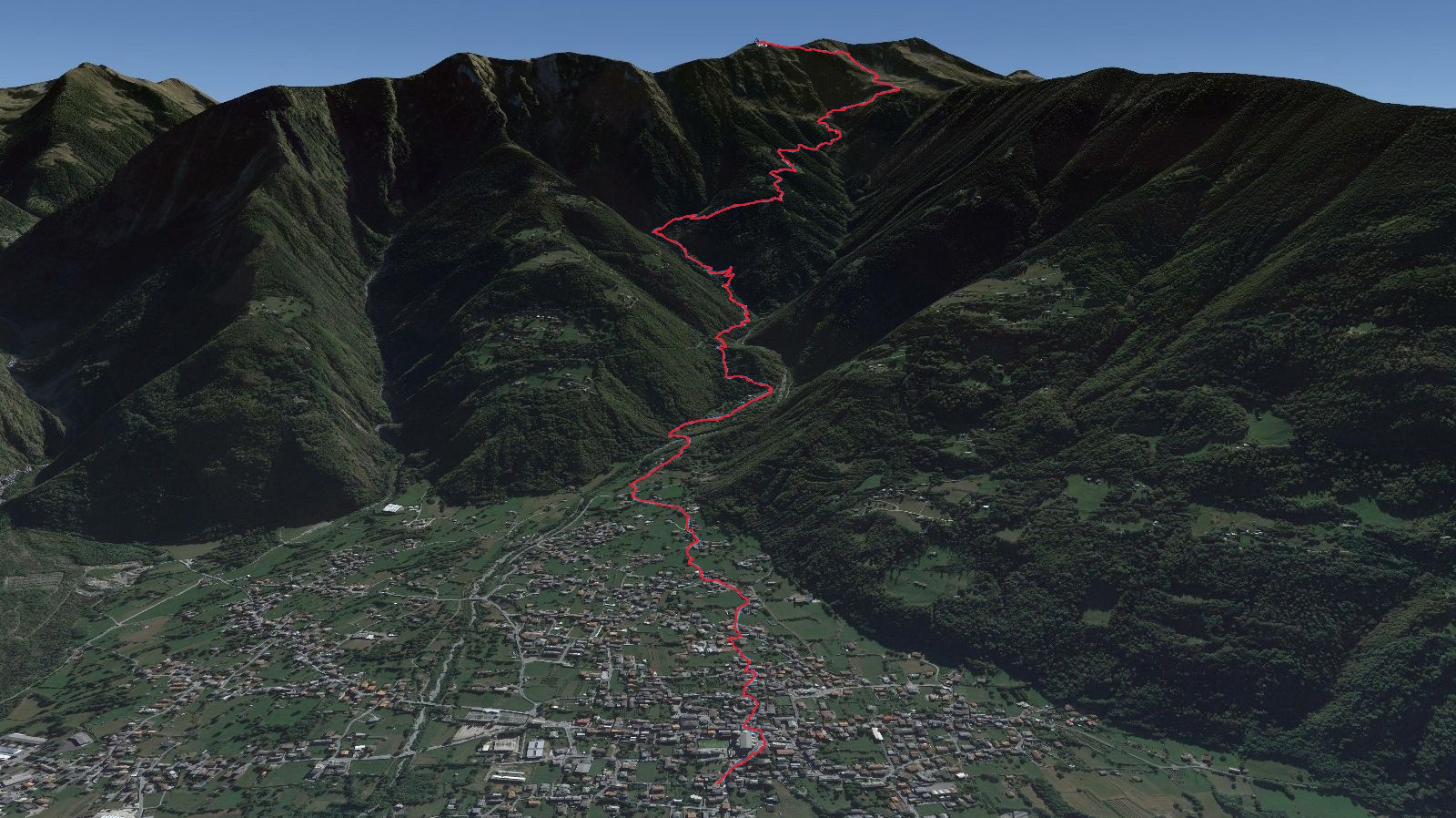
THE TRACK

PARTICIPANTS
The race provides for the maximum number of 200 racing bibs.

DIFFERENCE IN ALTITUDE
The altitude of the race extends for a total of 2000 meters, with an average gradient of 22% and a maximum gradient of 45%.

DISTANCE
The track extends over a total distance of 9000 meters.

RECORD
The race records were recorded in the 2019 edition by Michele Boscacci ITA with 1h 22 ’24 “and by Corinna Ghirardi ITA with 1h 42′ 06”.

PARTECIPANTS
The race provides for the maximum number of 200 racing bibs.

DIFFERENCE IN ALTITUDE
The altitude of the race extends for a total of 2000 meters, with an average gradient of 22% and maximum gradient of 45%.

DISTANCE
The track extends over a total distance og 9000 meters.

RECORD
The race records were recorded in the 2019 edition by Michele Boscacci ITA with 1h 22 ’24 “and by Corinna Ghirardi ITA with 1h 42′ 06”.

A stone’s throw from Lake Como, in a unique environment in the heart of the Orobie Valtellinesi Alps, on the paths in Talamona, a unique climb-only competition takes place, 2000 meters of positive difference in height in just 9 km of development, to be run all in a single breath to the summit, where the arrival is located on a spectacular panoramic ridge at the edge of the sky.
After the success of the last edition, the format and route were reconfirmed, starting from the parish Church in the heart of the Orobic city of Talamona at 272m and arriving at the panoramic Cima Pisello at 2272m.
The climb develops first on roads and mule tracks, then immediately climbing up steep wooded paths reaching the Madrera pasture and the Pedroria basin where the runners will pass in the middle of two wings of crowds, from here you go up a steep gully zigzag gaining the panoramic ridge that leads up to the summit where the arrival is located.
The view from up there is priceless, you have in front of a panorama that sweeps from the Upper Lario, to the lower Valtellina with the head of Val Masino as a frame and the Adamello in the background.
The race from the year 2021 has been included in the list of certified routes by the International Skyrunning Federation. (Download)
DOWNLOAD GPX AND KML TRACK
